
The Hammock & Malacompra waterfront guide
In the Hammock, a shoreline concern may involve a tidal edge, a drainage canal or a public outfall. Identify that connection before planning a wall.
Describe your project on this page ↓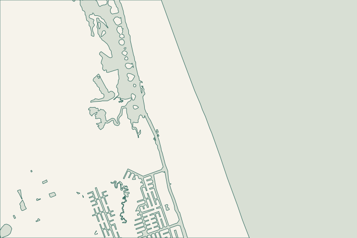
Get to know your waterfront
The Hammock’s waterfront context includes Bing’s Landing on the Intracoastal and the Malacompra drainage corridor. County planning identifies Armand Beach, Johnson Beach, Hammock Beach and Sea Colony as contributors to that system. A property concern here can therefore involve water coming toward the shoreline as well as water coming from it. Start with the flow route and the ownership of each affected feature.
Local geography and records: The Hammock & Malacompra · Bing’s Landing · Malacompra Canal restoration priority · Malacompra drainage restoration scope · Local tide and water-level gauges
Trace the public and private drainage interface
Have the assessor locate the private structure, public canal bank, culvert or outlet on one sketch. Ask the county which maintenance access must remain open. A public boat ramp is a geographic reference, not permission to stage heavy equipment; have the contractor confirm any loading location with its operator.
Local records worth knowing
- Bing’s Landing is on the Intracoastal west of A1A.
- The county describes the park as eight acres.
- The Malacompra drainage feature is approximately 4,200 feet long.
- County records name Armand Beach, Johnson Beach, Hammock Beach and Sea Colony in its basin.
- The corridor drains west across A1A toward the Intracoastal.
What could the work cost?
Include public-interface coordination and protection of drainage access. Separate private stabilization from a public canal-restoration scope, even if they meet at the property edge.
Published Florida planning ranges, not Palm Coast quotes. Confirm the full scope for your property.
Compare quotes and plan a budget →Find the relevant permits and records
| Starting point | What to resolve | Prepare and look up |
|---|---|---|
Flagler County Central Permitting | Confirm the parcel, proposed scope and current submission route. | Bring parcel ID, survey and the work description. 386-313-4003. |
Environmental and waterway review | Identify existing drainage approvals, habitat and any state or federal review. | Show alignment, access and all connected work. |
Trace the public and private drainage interface — your checklist
Use these steps to turn the local context into a property-specific project brief.
Mark the interface
Locate the structure, culvert and outlet relative to the parcel.
Local geography and records: The Hammock & Malacompra · Bing’s Landing
Request the basin record
Ask for the relevant Malacompra plans and current project limits.
Local geography and records: The Hammock & Malacompra · Bing’s Landing
Confirm staging permissions
Agree a lawful access route and restoration limits before mobilization.
Local geography and records: The Hammock & Malacompra · Bing’s Landing
Plan your The Hammock & Malacompra project
Describe the location and what has changed. Keep your survey and any earlier records with the project notes.
The Hammock & Malacompra project questions
Will the Malacompra project repair my private wall?
The planning records describe a public drainage project. Confirm the current boundary and scope with the county; do not assume a privately owned structure is included.
Keep planning
Nearby waterfront guides
Matanzas Shores & Marineland, Hammock Beach & Ocean Hammock, The Sanctuary
Show sourcesHide sources
- Local geography and records: The Hammock & MalacompraSource reviewed 2026-10-26
- Bing’s LandingSource reviewed 2026-10-26
- Malacompra Canal restoration prioritySource reviewed 2026-10-26
- Malacompra drainage restoration scopeSource reviewed 2026-10-26
- Local tide and water-level gaugesSource reviewed 2026-10-26
- Flagler County Central PermittingSource reviewed 2026-10-26
- DEP Northeast DistrictSource reviewed 2026-10-26
- SJRWMD ePermit resourcesSource reviewed 2026-10-26
- USACE Jacksonville officeSource reviewed 2026-10-26