Find your neighborhood or nearby coast. Each guide explains the local setting, records to request and questions to resolve before work.
Find your waterfront
Explore the coast. Find your starting point.
Saltwater canals, freshwater banks and the barrier coast. Explore the local records and questions that matter for your property.
Full local guide
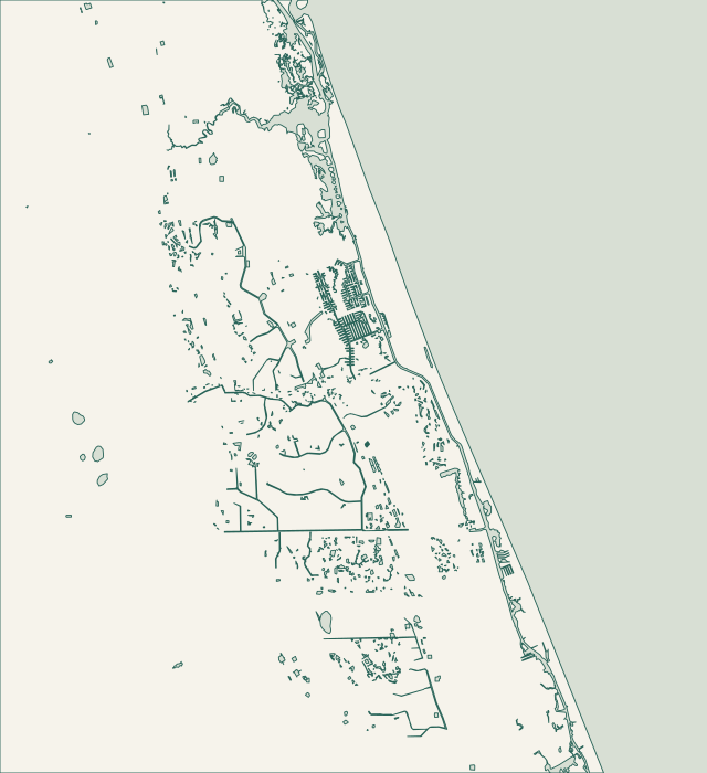
Choose a label to open local resources →Tap a community on the map or below ↗
Land: U.S. Census Bureau, minus Census and Palm Coast GIS water polygons. Community references: city GIS and Census boundaries. Snapshot: October 26, 2026. General orientation only; not a survey or service-availability boundary.
Your local starting point
Find your community.
Choose a guide for local maps, permit starting points and the records to gather for your property.
Follow the wall around the returns — your checklist
Palm Harbor’s C-section canals are mapped separately from the F-section neighborhood. Country Club Cove appears in city permit records, including work in Section 16. For a canal-front home, the useful question is not just how many feet of wall need attention: it is how the wall connects to the side returns, dock and adjoining properties. Confirm the parcel and the named canal before asking for a proposal.
Keep wall finals and drainage finals together — your checklist
The F-section side of Palm Harbor contains a network of individually named coves and channels. City GIS names Fanwood Cove and Fentress Channel, while permit records identify Florida Park Section 6. For owners here, a useful starting file combines the exact waterway, earlier wall work and any final stormwater result. One street’s completed project does not establish your wall’s material or condition.
Draw the responsibility boundary first — your checklist
Tidelands has its own polygon in Palm Coast’s neighborhood data, separate from Palm Harbor. The canal layer also identifies Club House Waterway at this neighborhood. An association shoreline, a drainage edge and an owner’s parcel can have different responsibilities even when they are close together. Start by matching the damaged section to the property and association documents, then request the approval for that exact feature.
Identify the system behind the visible stone — your checklist
The city maps Sanctuary separately from the neighboring Village area. Named waters around its mapped edge include Cimmaron and Cochise waterways. A city permit on Old Oak Drive South describes coquina seawall work with separate seawall and stormwater finals. Use that as a reason to establish your actual wall system and records; it is not evidence that every Sanctuary property has the same construction.
Protect the permitted bank profile — your checklist
Grand Haven’s association standards describe the community lakes as stormwater detention ponds. They are part of a permitted drainage system, with bank-slope and planting guidance. The district publishes pond-bank resources, while nearby Waterfront Park identifies the wider Intracoastal setting. Establish whether your concern is a pond bank, private wall or another shoreline feature; those are different scopes with different records.
Use the parcel to route the project — your checklist
Palm Coast Plantation is separately mapped in the city’s regional neighborhood layer and appears in Flagler County’s unincorporated community listings. That makes jurisdiction a practical first check, not a formality to leave until bidding. SeaGate Homes describes community access to the Intracoastal and the separate 126-acre freshwater Emerald Lake. Identify which edge belongs to the parcel, then check whether the work affects a private wall, common property or a permitted drainage bank.
Do not transfer a neighbor’s elevation or approval — your checklist
Hammock Dunes and Island Estates are separate polygons in the official neighborhood layer. The broader barrier-island setting brings several kinds of waterfront close together, but proximity does not give them the same approval path. Check the actual parcel, its water frontage and any common-property boundary. For ocean-facing work, locate the CCCL; for other edges, establish the drainage or marine permit history.
Separate ocean exposure from back-of-dune drainage — your checklist
Hammock Beach and Ocean Hammock are mapped as different communities. County planning identifies Hammock Beach among areas contributing drainage to the Malacompra system. That is a useful reason to investigate both the receiving drainage route and the immediate shoreline. A wet yard after a storm is not by itself evidence that an oceanfront wall or higher barrier is the right intervention.
Trace the public and private drainage interface — your checklist
The Hammock’s waterfront context includes Bing’s Landing on the Intracoastal and the Malacompra drainage corridor. County planning identifies Armand Beach, Johnson Beach, Hammock Beach and Sea Colony as contributors to that system. A property concern here can therefore involve water coming toward the shoreline as well as water coming from it. Start with the flow route and the ownership of each affected feature.
Establish the boundary before the application — your checklist
Matanzas Shores appears as its own official neighborhood, while Marineland is a separate incorporated town. River to Sea Preserve spans A1A between the Atlantic and Matanzas River and is jointly held by the county and town. This narrow coastal setting is a reminder to identify both the jurisdiction and the side of the barrier before planning excavation, shoreline stabilization or marine access.
Bring the wall and grading questions together — your checklist
Flagler Beach has its own Building and Engineering office at the Wickline Building. The city publishes marine construction and separate grading or drainage forms. Betty Steflik Preserve documents the local salt-marsh and black-mangrove setting, while the county links Smith Creek tide information. These resources help distinguish a tidal waterfront assessment from an oceanfront coastal-armoring question.
Split the old records search from the new application — your checklist
Beverly Beach is an incorporated town with a permitting change that matters to waterfront owners. Its official notice identifies Flagler County as the building, engineering and development provider from January 1, 2026. The town directs historical permit inquiries toward the previous provider, Flagler Beach. Put the year and permit number on a records request so the correct office can find the file.
Record levels before choosing a bank treatment — your checklist
The city maps Belle Terre P-1, Pine Grove P-2 and Lehigh Woods as distinct neighborhoods connected to named freshwater waterways. Its canal page describes Pine Grove dredging coordinated with the P-1 weir near Belle Terre Boulevard. If exposed bank or standing water prompted your search, ask about managed canal levels and current public work before treating the observation as a failed private seawall.
Make a location-specific maintenance report — your checklist
Indian Trails, Pine Lakes and Matanzas Woods are mapped as separate letter-section neighborhoods. Their canal records include Barrister Waterway, the Wynnfield waterways and London Waterway segments. A drainage-bank concern here should be tied to the correct named feature. A tidal canal repair elsewhere in Palm Coast is not a direct model for a freshwater channel that carries runoff through the neighborhood.
Ask which control affects your property — your checklist
Seminole Woods and Quail Hollow occupy several letter-section polygons in the city dataset. Named waterways include Ulysses, Seminole and Iroquois features. The city’s legislative priorities separately identify a proposal to lower the Seminole Woods Dry Lake Weir. For a property decision, establish which basin serves the parcel and whether a proposed or ongoing public project is actually connected to it.
Keep fill and storage in the same conversation — your checklist
Woodlands is a distinct neighborhood in the city GIS. Palm Coast identifies additional stormwater storage there among its legislative priorities, rather than describing a universal private seawall repair program. Before planning work near a water or wetland edge, locate the parcel boundary, drainage easements and existing approvals. The useful question is how the proposed work affects the flow path and storage around the property.