
Grand Haven waterfront guide
Grand Haven pond-bank work is a drainage and community-approval question. Distinguish it from an Intracoastal seawall project before choosing a repair.
Describe your project on this page ↓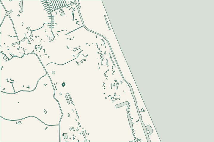
Get to know your waterfront
Grand Haven’s association standards describe the community lakes as stormwater detention ponds. They are part of a permitted drainage system, with bank-slope and planting guidance. The district publishes pond-bank resources, while nearby Waterfront Park identifies the wider Intracoastal setting. Establish whether your concern is a pond bank, private wall or another shoreline feature; those are different scopes with different records.
Local geography and records: Grand Haven · Grand Haven ADC standards, June 2024 · Grand Haven district records · Waterfront Park · SJRWMD ePermit resources
Protect the permitted bank profile — your checklist
Use these steps to turn the local context into a property-specific project brief.
Identify the pond or shoreline
Use the community plan and a dated location sketch.
Local geography and records: Grand Haven · Grand Haven ADC standards, June 2024
Request the current standard
Confirm the applicable association and CDD documents.
Local geography and records: Grand Haven · Grand Haven ADC standards, June 2024
Agree the maintenance handover
Name who monitors the repaired bank and reports changes.
Local geography and records: Grand Haven · Grand Haven ADC standards, June 2024
Protect the permitted bank profile
Ask the district and association for the current maintenance responsibility and approved bank detail. Have the professional identify whether exposed soil reflects a grade change, concentrated runoff, vegetation loss or another cause. Do not turn a pond-edge landscaping problem into a new retaining wall without checking the drainage design.
Local records worth knowing
- Grand Haven’s standards identify its lakes as stormwater detention ponds.
- The standards describe preserving designed bank slopes.
- The CDD publishes a detention-pond planting resource.
- The neighborhood GIS includes a Grand Haven Wild Oaks/The Crossings feature.
- Waterfront Park at 150 Waterfront Park Road provides nearby Intracoastal context.
What could the work cost?
Separate district work, homeowner landscaping and any structural assessment. Include plant establishment and follow-up when a bank-restoration scope relies on vegetation.
Published Florida planning ranges, not Palm Coast quotes. Confirm the full scope for your property.
Compare quotes and plan a budget →Find the relevant permits and records
| Starting point | What to resolve | Prepare and look up |
|---|---|---|
Palm Coast Building Services | Confirm the parcel, proposed scope and current submission route. | Bring parcel ID, survey and the work description. 386-986-3780. |
Environmental and waterway review | Identify existing drainage approvals, habitat and any state or federal review. | Show alignment, access and all connected work. |
Plan your Grand Haven project
Describe the location and what has changed. Keep your survey and any earlier records with the project notes.
Grand Haven project questions
Should every eroding Grand Haven pond bank receive a seawall?
No. Review the permitted pond profile, erosion cause and community standards first. A structural wall may be unnecessary or inconsistent with the existing drainage plan.
Grand Haven ADC standards, June 2024 · Grand Haven district records
Keep planning
Nearby waterfront guides
Show sourcesHide sources
- Local geography and records: Grand HavenSource reviewed 2026-10-26
- Grand Haven ADC standards, June 2024Source reviewed 2026-10-26
- Grand Haven district recordsSource reviewed 2026-10-26
- Waterfront ParkSource reviewed 2026-10-26
- SJRWMD ePermit resourcesSource reviewed 2026-10-26
- Palm Coast Building ServicesSource reviewed 2026-10-26
- DEP Northeast DistrictSource reviewed 2026-10-26
- USACE Jacksonville officeSource reviewed 2026-10-26