
Seminole Woods & Quail Hollow waterfront guide
Connect a Seminole Woods or Quail Hollow bank concern to the correct drainage reach. The Dry Lake Weir proposal is context, not a private repair commitment.
Describe your project on this page ↓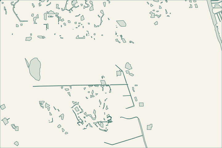
Get to know your waterfront
Seminole Woods and Quail Hollow occupy several letter-section polygons in the city dataset. Named waterways include Ulysses, Seminole and Iroquois features. The city’s legislative priorities separately identify a proposal to lower the Seminole Woods Dry Lake Weir. For a property decision, establish which basin serves the parcel and whether a proposed or ongoing public project is actually connected to it.
Local geography and records: Seminole Woods & Quail Hollow · Seminole Woods Dry Lake Weir · Official canal inventory · Freshwater canal function · Stormwater 101
Ask which control affects your property
Show the receiving waterway and any culvert or inlet on a location sketch. Ask the city which basin and control structure apply. Record repeated high-water or bank observations with dates, but avoid treating a neighborhood-wide proposal as a confirmed fix for a specific lot.
Local records worth knowing
- The GIS divides Seminole Woods into S and U sections.
- Quail Hollow is represented by K, LL and Z sections.
- Ulysses Waterway appears in the Seminole Woods network.
- Iroquois Canal segments are separately mapped.
- The city identifies Dry Lake Weir lowering as a stormwater priority.
What could the work cost?
Separate a private stability assessment from anticipated public-system changes. Get the bank-restoration scope and approval in writing rather than basing a quote on an unconfirmed future water level.
Published Florida planning ranges, not Palm Coast quotes. Confirm the full scope for your property.
Compare quotes and plan a budget →Find the relevant permits and records
| Starting point | What to resolve | Prepare and look up |
|---|---|---|
Palm Coast Building Services | Confirm the parcel, proposed scope and current submission route. | Bring parcel ID, survey and the work description. 386-986-3780. |
Environmental and waterway review | Identify existing drainage approvals, habitat and any state or federal review. | Show alignment, access and all connected work. |
Ask which control affects your property — your checklist
Use these steps to turn the local context into a property-specific project brief.
Identify the basin
Use the parcel and receiving waterway to ask the city for the relevant drainage record.
Local geography and records: Seminole Woods & Quail Hollow · Seminole Woods Dry Lake Weir
Check project status
Distinguish a legislative request from funded and issued construction.
Local geography and records: Seminole Woods & Quail Hollow · Seminole Woods Dry Lake Weir
Document recurring changes
Keep dated observations that a professional can compare.
Local geography and records: Seminole Woods & Quail Hollow · Seminole Woods Dry Lake Weir
Plan your Seminole Woods & Quail Hollow project
Describe the location and what has changed. Keep your survey and any earlier records with the project notes.
Seminole Woods & Quail Hollow project questions
Does the Dry Lake Weir priority mean my bank will be repaired?
No. A public drainage priority does not establish a private bank-repair scope or completion date. Confirm the project limits and your property’s connection separately.
Keep planning
Nearby waterfront guides
Show sourcesHide sources
- Local geography and records: Seminole Woods & Quail HollowSource reviewed 2026-10-26
- Seminole Woods Dry Lake WeirSource reviewed 2026-10-26
- Official canal inventorySource reviewed 2026-10-26
- Freshwater canal functionSource reviewed 2026-10-26
- Stormwater 101Source reviewed 2026-10-26
- Palm Coast Building ServicesSource reviewed 2026-10-26
- DEP Northeast DistrictSource reviewed 2026-10-26
- SJRWMD ePermit resourcesSource reviewed 2026-10-26
- USACE Jacksonville officeSource reviewed 2026-10-26